3D visual information and GIS technologies for paintings’ documentation in the M Sepulchre in the Vatican Necropolis |
 |
|||
VRML |
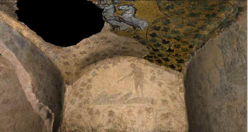
VRML reconstruction The Virtual Reality Modelling Language (VRML), is a 3D modelling language for virtual reality applications using 3D scenes. On the basis of the definition of the VRML consortium, VRML is an open standard for 3D virtual and multimedia worlds, connected and linked by Internet. In December 1997, VRML has been classified as an international standard (ISO/IEC-14772-1:1997) from ISO (International Standard Organisation) and from the International Electrotechnical Commission. So, the VRML was created in order to permit a standard access on the web to interactive virtual environments; in fact, in a few years, it has become the most used language for the representation of 3D scenes on line. Furthermore the new powerful versions of VRML (2.0 and VRML97) allow specific tools for animations and interactions with the users, very important in the field of virtual reality. Furthermore in our project, after the GIS applications, we completed the 3D reconstruction of the tomb in VRML (fig.10), so that the whole monument could be explored in real time, including textures (foto-mosaics of the walls) and geometry. The VRML model can be visualised using freeware browsers that can be downloaded from the Internet; to view our reconstruction we use Cosmo Player (created by Silicon Graphics, http://www.cai.com/cosmo/). In this way the access to VRML models is open to everybody. For instance the 3D models were created and explored using Cosmo Player 2.1 (Silicon Graphics) as browser. Using the virtual console of the browser, and visualising the model, it is possible to move forward and back, turn left and right, tilt up and down, seeking, sliding, and so on. The interaction in real time and a user friendly interface allows us to describe the model as a cognitive model: in fact during the virtual navigation we perceive new information and new ways of visualisation, without the need to have GIS software for representing the data. Click on this image for visualising the VRML models |
Perspectives of the project
|
||